-
PROTOTYPE HISTORY
-
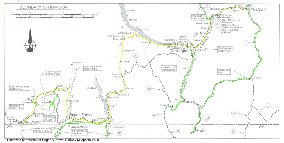
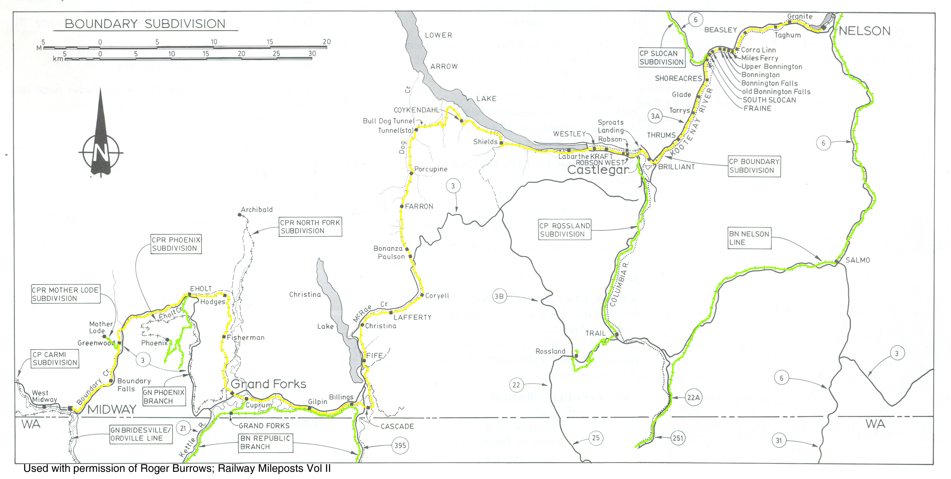
The Boundary Subdivision, located in south eastern British Columbia, had its beginnings in 1890 when the CPR chartered the Columbia and Kootenay Railway & Navigation Co. to run from Nelson on the Kootenay Lake overland west to the Columbia River. Service began in 1891 between Nelson and Sproat’s Landing which is across the Columbia River from Castlegar. Completion of the C&K allowed Nelson ores to be transported north on the Columbia River lake boats to the CPR mainline at Revelstoke, and was a significant defensive strategy to combat the Great Northern’s inroads into British Columbia. A short westward extension of the C&K from Sproat’s Landing to Robson allowed for the construction of a rail barge slip at that location.
In 1898 the CPR purchased the Columbia & Western Railway (C&W) and with it, the line from Rossland to West Robson. The following year the CPR extended this line westward over the Rossland Range of the Monashee Mountains to Grand Forks, and by 1900 it advanced further west and reached Midway where it connected with the Kettle Valley Railway. This in turn provided a direct link through southwestern British Columbia to Vancouver on the pacific coast.
Barges originally crossed the Columbia River and connected the C&K and the C&W railways between Robson and West Robson near Castlegar. This was a cumbersome and inefficient operation, and as a result, in 1902, the Columbia River Bridge was completed which eliminated the need for the barge and created a continuous line from Nelson to Midway; a distance of 126 miles. In 1910 the CPR renamed this line; the Boundary Subdivision due to its proximity to the “boundary” between Canada and the United States.
Connecting branch lines were also built into the copper rich area of Phoenix, and north long the Slocan River to Slocan Lake where another lake barge service connected further north to the Kaslo Subdivision at Rosebery.
-
PROTOTYPE Map